Are your drones struggling with positioning errors, mapping inconsistencies, or navigation instability? Many UAV operators face the same challenge: standard GPS modules cannot provide the accuracy and reliability needed for professional surveying, mapping, or inspection tasks. Selecting the right high-precision CORS GNSS module for drones can significantly improve flight stability, data accuracy, and operational efficiency.
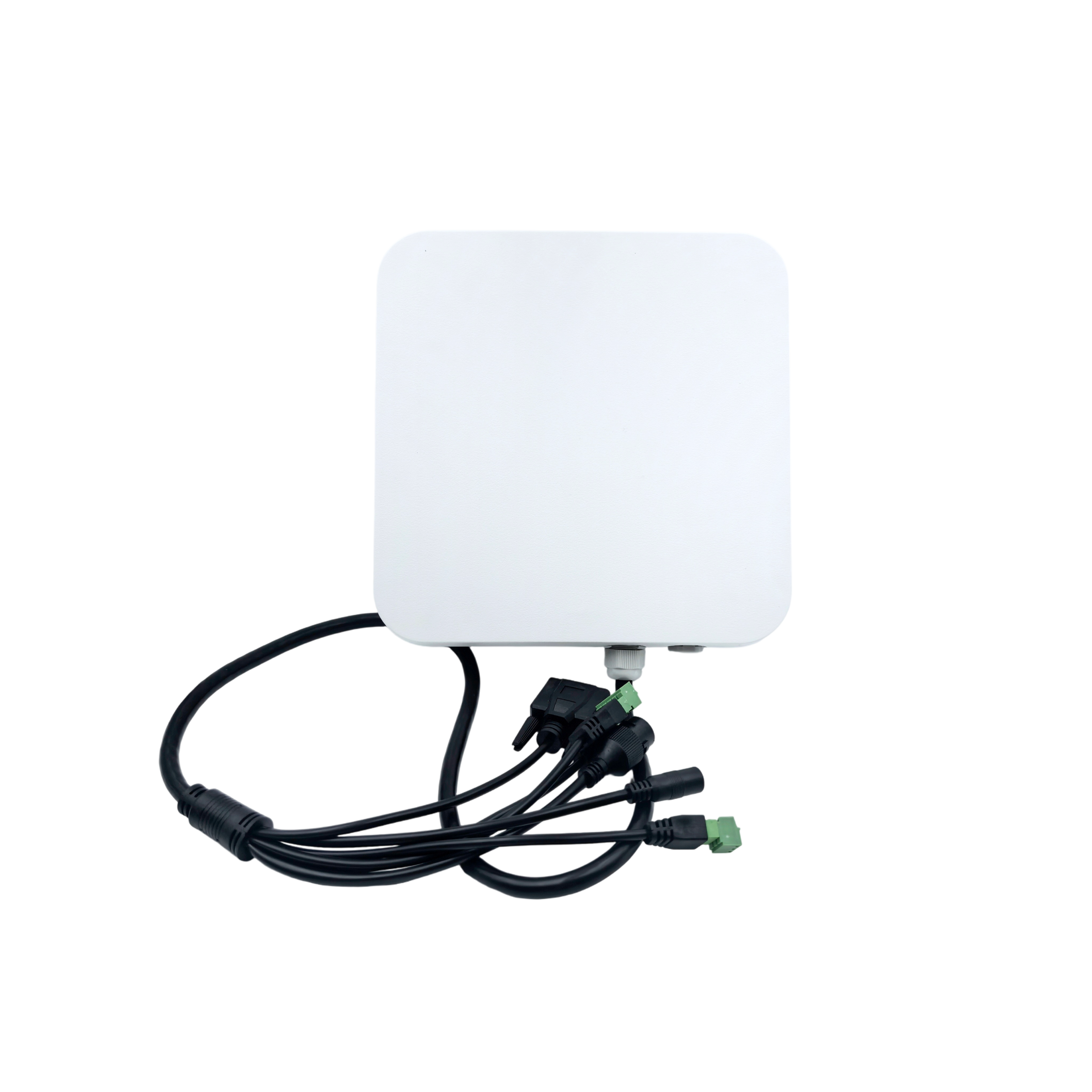
A high-precision CORS GNSS module for drones combines satellite signals from multiple global navigation systems and real-time corrections from Continuously Operating Reference Stations (CORS). This setup ensures centimeter-level positioning for your UAVs, making them suitable for professional applications such as precision agriculture, infrastructure inspection, and aerial surveying.
What Is a High-Precision CORS GNSS Module for Drones
A high-precision CORS GNSS module for drones is a compact navigation system that integrates multi-constellation GNSS reception with real-time corrections from CORS networks. Unlike standard GPS modules, these devices provide high-accuracy positioning even in challenging environments, enabling drones to capture precise geospatial data.
Key capabilities include:
Real-time kinematic (RTK) corrections
Post-processed kinematic (PPK) workflows
Multi-constellation support (GPS, BeiDou, GLONASS, Galileo)
Low-latency data output for flight controllers
These modules are ideal for UAVs performing tasks where precise coordinates are critical.
Why Standard Drone GNSS Modules Fall Short
Limited Accuracy
Typical GPS modules for drones provide positioning accuracy of 3–10 meters. This is insufficient for professional applications such as mapping, infrastructure inspection, or precision spraying. Even small errors can compromise survey results and data integrity.
Poor Performance in Challenging Environments
Urban areas, forests, or industrial sites often block satellite signals. Standard modules struggle to maintain accurate positioning in these conditions, leading to data gaps or flight instability.
Lack of Real-Time Correction
Without real-time correction, drones cannot achieve centimeter-level accuracy. High-precision CORS GNSS modules for drones integrate RTK or PPK corrections to overcome this limitation.
How High-Precision CORS GNSS Modules Work
Integration with CORS Networks
CORS networks consist of permanent ground-based GNSS reference stations. These stations continuously collect satellite data and transmit correction information to mobile GNSS receivers.
A high-precision CORS GNSS module for drones receives these corrections in real time, improving positional accuracy from meters to centimeters.
Multi-Constellation and Multi-Frequency Reception
Modern modules receive signals from multiple satellite systems across multiple frequency bands. This improves signal reliability and reduces the impact of atmospheric errors.
By combining GPS, BeiDou, GLONASS, and Galileo signals, drones maintain accurate positioning even in partially obstructed environments.
Applications of High-Precision CORS GNSS Modules in Drone Operations
Aerial Mapping and Surveying
Drones equipped with high-precision CORS GNSS modules can produce accurate orthomosaic maps, digital elevation models, and 3D terrain models. Centimeter-level accuracy reduces the need for ground control points, saving time and labor costs.
Infrastructure Inspection
For inspecting bridges, pipelines, power lines, and industrial facilities, precise positioning ensures drones capture consistent imagery along defined paths. This is critical for monitoring structural health over time.
Precision Agriculture
Agricultural UAVs rely on exact positioning for crop spraying, field mapping, and irrigation monitoring. High-precision CORS GNSS modules allow drones to minimize overlap, optimize routes, and improve operational efficiency.
Autonomous Flight and Beyond Visual Line-of-Sight (BVLOS) Operations
High-precision GNSS positioning is essential for fully autonomous UAV operations. Reliable CORS-corrected data enables drones to safely navigate complex flight paths, maintain stability in variable conditions, and operate BVLOS.
Key Features to Evaluate When Selecting a Module
| Feature | Standard GPS Module | High-Precision CORS GNSS Module | Why It Matters |
|---|---|---|---|
| Position Accuracy | 3–10 meters | 1–3 centimeters (with RTK) | Critical for mapping and surveying |
| Multi-Constellation Support | GPS only | GPS + BeiDou + GLONASS + Galileo | Ensures positioning reliability |
| RTK / PPK Support | No | Yes | Provides real-time or post-processed high-accuracy data |
| Environmental Resistance | Basic | Industrial-grade, IP67 | Maintains performance in harsh conditions |
| Integration with UAVs | Limited | Flexible with flight controllers | Ensures seamless operation |
| Data Latency | High | Low | Essential for real-time flight control |
This table highlights why procurement teams should prioritize high-precision CORS GNSS modules over standard GPS receivers.
Advantages of Using High-Precision CORS GNSS Modules
Improved Mapping Accuracy
Accurate positioning ensures high-quality data for surveyors, engineers, and geospatial analysts. Drone imagery aligns with real-world coordinates, reducing the need for manual corrections.
Reduced Flight Time and Operational Costs
Precise GNSS guidance minimizes repeated flights caused by positioning errors. Drones can complete missions more efficiently, saving fuel, battery life, and labor.
Enhanced Reliability in Complex Environments
With multi-constellation support and CORS corrections, modules maintain accuracy in urban, forested, and industrial areas. This ensures consistent data collection even under challenging conditions.
Scalability for Multiple Drone Platforms
High-precision modules can be integrated into various UAV types, from small quadcopters to industrial fixed-wing drones. This flexibility supports fleet operations across different projects.
Common Mistakes Buyers Should Avoid
Selecting generic GPS modules without RTK or PPK capabilities
Ignoring multi-constellation compatibility, which reduces signal reliability
Overlooking environmental protection features for outdoor operations
Failing to consider software and flight controller integration
Choosing a reliable supplier ensures that these common issues are avoided, and drones deliver optimal performance.
How to Choose a Supplier
When looking for a high-precision CORS GNSS module for drones, consider the following:
Experience and Track Record: Verify if the supplier has a proven history in UAV GNSS systems.
Technical Support: Ensure the supplier provides installation guidance, firmware updates, and troubleshooting.
Customization Options: Look for modules that can be tailored to specific UAV platforms or mission requirements.
Cost vs. Value: Evaluate total cost, including software, support, and maintenance, not just the purchase price.
A well-chosen supplier ensures reliable performance, long-term support, and consistent positioning accuracy.
Conclusion
A high-precision CORS GNSS module for drones is a critical investment for UAV operators in surveying, mapping, agriculture, and inspection industries. By providing real-time CORS corrections, multi-constellation support, and centimeter-level accuracy, these modules dramatically improve drone performance.
When selecting a module, focus on accuracy, environmental resistance, software integration, and supplier reliability. Choosing the right system reduces errors, increases operational efficiency, and ensures high-quality geospatial data collection.
For procurement teams and UAV operators, investing in a high-precision CORS GNSS module for drones is essential for safe, efficient, and precise drone operations.
https://www.keplergnss.com/nrtk-cors-signal-management-broadcasting-software.html
KEPLER